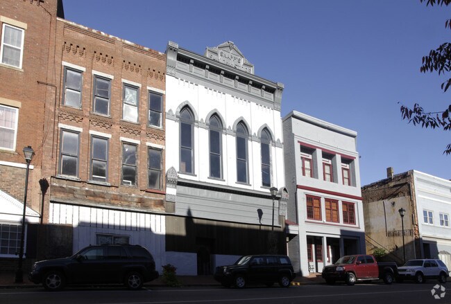
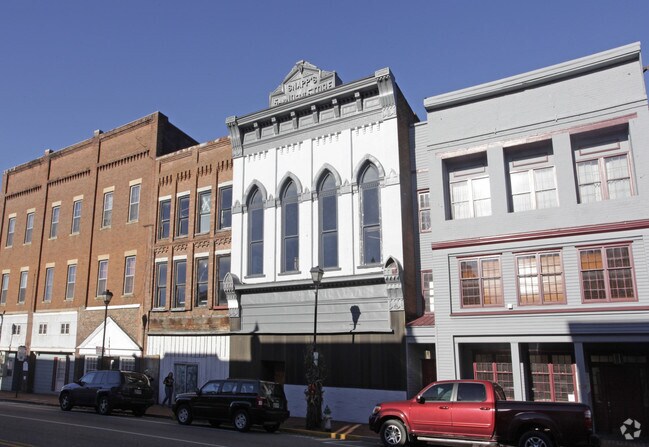
Property Record
313 S Main St, Greeneville, TN 37743
NEARBY LISTINGS FOR SALE OR LEASE
-
-
View all Greeneville listings for sale on LoopNet.com
Property Detail
313 S Main St
098L-L-017.00
29M X 130M
Commercialnec
Greene
X
Tennessee
47059C0237D
0.06 AC
2024
Tennessee East Area
2025
Other Market Areas
090502
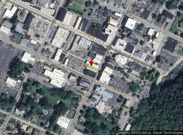
Greeneville, TN
3,036 SF
DEMOGRAPHICS near 313 S Main St
1 Mile
3 Mile
5 Mile
2024 Total Population
5,024
18,967
30,431
2029 Population
5,339
20,022
32,075
Pop Growth 2024-2029
+ 6.27%
+ 5.56%
+ 5.40%
Average Age
41
43
42
2024 Total Households
2,090
8,031
12,359
HH Growth 2024-2029
+ 6.46%
+ 5.65%
+ 5.53%
Median Household Inc
$51,463
$55,673
$56,019
Avg Household Size
2.20
2.30
2.30
2024 Avg HH Vehicles
2.00
2.00
2.00
Median Home Value
$153,709
$176,094
$183,641
Median Year Built
1960
1972
1975
Nearby Places
Map Layers
Map Styles
 Street
 Aerial
- Restaurants
- Banks
- Shops
- Fitness
- Groceries
PUBLIC TRANSPORTATION
AIRPORT
Tri-Cities
DRIVE
WALK
Distance
Tri-Cities
54 min
37.7 mi
SALE & LEASE HISTORY
LISTING DATE
SALE/LEASE

Jan 03, 2017
For Sale
Nearby Properties
Address
Land Use
TOTAL SIZE
Lot Size
Zoning
Address
Land Use
TOTAL SIZE
Lot Size
Zoning
1,070,100 SF
64.36 AC
M1
Address
Land Use
TOTAL SIZE
Lot Size
Zoning
45,288 SF
4.78 AC
MR
Address
Land Use
TOTAL SIZE
Lot Size
Zoning
84,285 SF
4 AC
B4
Address
Land Use
TOTAL SIZE
Lot Size
Zoning
121,886 SF
15.57 AC
B4
Address
Land Use
TOTAL SIZE
Lot Size
Zoning
2,160 SF
6.96 AC
B4
Address
Land Use
TOTAL SIZE
Lot Size
Zoning
76,206 SF
18.08 AC
R4
Address
Land Use
TOTAL SIZE
Lot Size
Zoning
111,495 SF
9.82 AC
M2
Address
Land Use
TOTAL SIZE
Lot Size
Zoning
57,390 SF
Address
Land Use
TOTAL SIZE
Lot Size
Zoning
28,476 SF
7.30 AC
M1
Address
Land Use
TOTAL SIZE
Lot Size
Zoning
49,276 SF
4 AC
Address
Land Use
TOTAL SIZE
Lot Size
Zoning
4,367 SF
10.20 AC
B4
Address
Land Use
TOTAL SIZE
Lot Size
Zoning
389,266 SF
20.78 AC
A1
Address
Land Use
TOTAL SIZE
Lot Size
Zoning
50,806 SF
6.14 AC
A1
Address
Land Use
TOTAL SIZE
Lot Size
Zoning
39,910 SF
5.50 AC
A1
Address
Land Use
TOTAL SIZE
Lot Size
Zoning
64,800 SF
A1
Address
Land Use
TOTAL SIZE
Lot Size
Zoning
51,265 SF
4 AC
Address
Land Use
TOTAL SIZE
Lot Size
Zoning
153,422 SF
19.56 AC
M1
Address
Land Use
TOTAL SIZE
Lot Size
Zoning
70,123 SF
1.10 AC
A1
Address
Land Use
TOTAL SIZE
Lot Size
Zoning
44,415 SF
5.23 AC
A1
Address
Land Use
TOTAL SIZE
Lot Size
Zoning
11,016 SF
6.50 AC
B4
Address
Land Use
TOTAL SIZE
Lot Size
Zoning
165,500 SF
23 AC
M1
Address
Land Use
TOTAL SIZE
Lot Size
Zoning
27,117 SF
2.77 AC
A1
Address
Land Use
TOTAL SIZE
Lot Size
Zoning
67,200 SF
11.88 AC
M1
Address
Land Use
TOTAL SIZE
Lot Size
Zoning
5,596 SF
2.74 AC
R1
Address
Land Use
TOTAL SIZE
Lot Size
Zoning
92,764 SF
9.57 AC
A1
Address
Land Use
TOTAL SIZE
Lot Size
Zoning
44,908 SF
5.67 AC
B4
Address
Land Use
TOTAL SIZE
Lot Size
Zoning
29,022 SF
10.60 AC
B4
Address
Land Use
TOTAL SIZE
Lot Size
Zoning
42,771 SF
4.25 AC
M2
Address
Land Use
TOTAL SIZE
Lot Size
Zoning
40,260 SF
5.03 AC
B4
Address
Land Use
TOTAL SIZE
Lot Size
Zoning
20,820 SF
150 AC
B2
The World's #1 Commercial Real Estate Marketplace
Connect with us
© 2025 CoStar Group
The information above has been obtained from sources believed reliable. While we do not doubt its accuracy we have not verified it and make no guarantee, warranty or representation about it. It is your responsibility to independently confirm its accuracy and completeness. Any projections, opinions, assumptions, or estimates used are for example only and do not represent the current or future performance of the property. The value of this transaction to you depends on tax and other factors which should be evaluated by your tax, financial, and legal advisors. You and your advisors should conduct a careful, independent investigation of the property to determine to your satisfaction the suitability of the property for your needs.